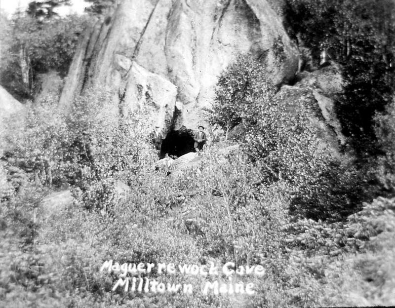
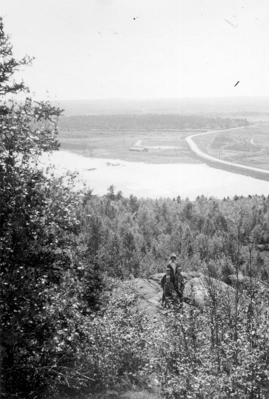
Above is a photo of a gent sitting in front of Maguerrewock Cave, or Maguerrowoc Cave or any of ten other spellings found in various articles about this section of Milltown. We will use Maguerrowoc as it is favored by the historian Ned Lamb. The cave and the rock formation are just off the Icehouse Road on the Moosehorn and are quite easy to access. The Icehouse Road is the road to left just before Maguerrowoc stream and marsh and the trail to the top is very near Route 1. As you will see from the other photos the view from the top is well worth the climb, which is not at all difficult. Maguerrowoc is Passamaquoddy for Caribou, a species which inhabited the area in very large numbers before the white man arrived. It has always been a place of legend and mystery inhabited by lake monsters and hidden fortunes of gold under its rocky ledges but more on that below.
Maguerrowoc Cave is at the base of Maguerrowoc Mountain which anchors the northern end of Maguerrowoc Ridge. The ridge runs from Milltown to Robbinston generally parallel with the river. There is a spur which runs across South Street, then across Garfield and Union and over the River to Dover and Buchanan Hills on the Canadian side. This is what Ned Lamb, the dean of Calais historians, has to say about Maguerrowoc.
“The vast majority of the people of Calais know little of the larger
part of the City. Calais has not quite 31 square miles of territory
and 13 square miles is all the ordinary dweller in the City limits is
in any way acquainted with. The steep and rocky ridge that starts with Maguerrowoc and roughly parallels the river, forces the City to keep close to the bank of the St. Croix, and as there are few breaks in the ridge, there is no settled “back country” for the city. A spur of the
ridge is thrown off for Deshon’s Hill and probably in some past
geological age was connected to Buchanan’s Hill across the river and
the whole lower valley of the St. Croix above tide water was a vast
lake. What are Salmon Falls was the last remains of this larger cataract. The slope of the ridge on which the city is built is mostly towards the north and northwest and exposes the city to the benefits of the cold winds that blow from those quarters about nine months in the year, and very little land slopes toward the south as farmers like for early crops. Back of this ridge lies the unknown part of the city.”
The presence of Maguerrwoc Ridge is the reason all the lakes down to Robbinston drain into the St Croix at Maguerrowoc rather than directly into the river, they can’t get across Maguerrwoc Ridge. The only exception is Plaster Mill Stream in Red Beach which had enough water in it to run the Red Beach mills because a costly canal was built from waters of Maguerrowoc to Beaver Lake which is the source of the Plaster Mills Stream.
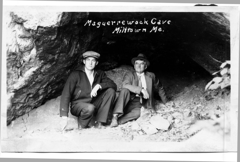
The mouth of the cave seems to promise a wide and accommodating passage into the mountain and beyond and certainly many of the old timers told stories about the cave which made such claims. However, the truth appears otherwise as established by more contemporary accounts. Larry Lane often went there as a boy as did Steve Vose who crawled into the cave for 25 feet or so to test the rumor it went all the way to Robbinston. He doesn’t say why he stopped at 25 feet, but it may be because the “cave” is not, as Alex Markoff speculates, a true cave but just an opening formed by boulders deposited during the Ice Age. Larry says:
“I too have crawled as far into the cave as I could really hoping it would open up into a room or something as I heard the old folks indicate but it just narrowed into nothing. I could put my hand and arm into a little hole, but it was all rock around it and I can’t figure how the old folks thought there was an entrance there. Oh, well”
Not many people visit the cave these days although Dave Mitchell says the scouts once hiked up there every year. Perhaps some scout can earn a merit badge by crawling in and coming out on Trimble Mountain in Robbinston. Dave says his daughter Emily went into the cave, but thought it might be inhabited by a bear, so she retreated. The rumor among the scouts was that there was a counterfeiting machine in the cave, but this appears to be a conflation of the rumor the cave went all the way to Robbinston and the Moneymaker Lake murder of Sheriff Downes by the counterfeiter Ball.
Eleanor Clark say she and Norman took kids to the top of the cave for hot dog roasts and the great view across the marsh and up the river looking toward Baring and the Charlotte Road.
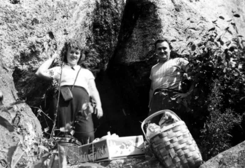
In this 1948 photo a couple seems to be moving in for an extended stay.
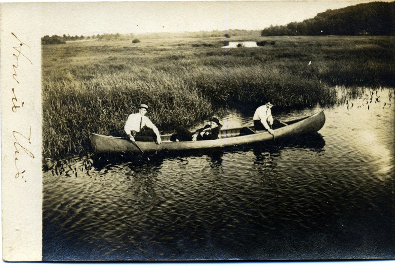
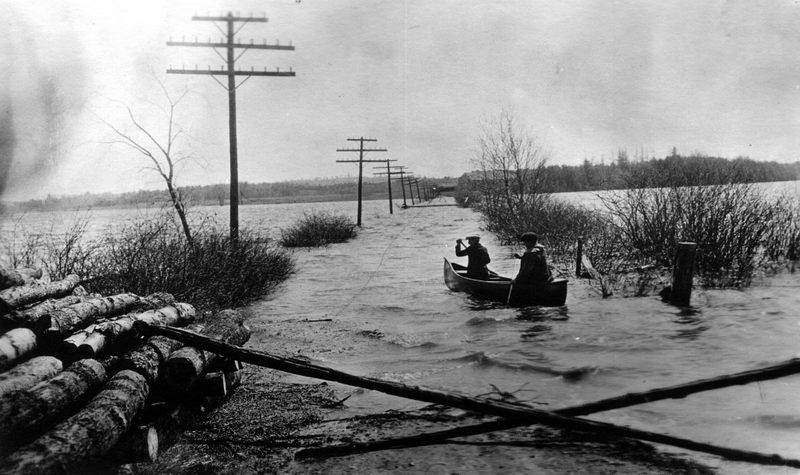
A relaxing day canoeing on Maguerrowoc Marsh was undoubtedly very pleasant unless, of course, your party happened to encounter the Maguerrowoc Monster. This from a 1906 newspaper clipping from what we believe was the Calais Advertiser:
“Last Sunday Mr. Joseph Curtis, Phillie Smith and Mr. Robert McDonald were looking over some property, skirting the shore of Maguerrowoc Lake when they saw what appeared to be a good-sized steamer crossing the lake. When first noticed the object appeared to be a about a mile distant and coming towards them. They could see great paddle wheels churning the water and great quantities of spray flying over what looked like the bow of the boat. As they watched a large water sprout shot out of the lake apparently right ahead of the object and a tremendous roar echoed and reechoed over the lake and through the woods. Every minute the thing was coming closer. It made straight for the shore and when 50 yards away the sight almost froze the blood in the bodies. Terror stricken they turned to flee. Gaining the top of the hill they turned to see a tail as large as the light house on Doucet’s Island disappear in the heaving water of the lake. The gentlemen agree in saying the object was at least two hundred feet long, 30 feet wide and had a head which beggars’ description. Place the heads of 50 horses on a large steam engine and you had some idea of the description to give. Every head and eye moving rapidly. What is it? How did it get there? Is the dreaded sea serpent a captive of these waters.?”
Unfortunately, there is some text cut off the end of the article so we don’t know if these questions were ever answered. We can report that no further sightings of the “monster” are on record. We do know that Joseph Curtis was from Red Beach and as far as we can tell was a fairly reputable citizen.
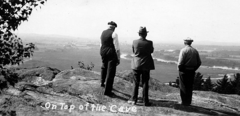
The fellows above are looking out over the marsh and stream perhaps contemplating the prospect of the riches beneath their feet. They may have read the articles that appeared from time to time about Maguerrowoc’s gold. For instance, this article in the Advertiser in the early 1900’s enlightens us on the source of some of the Maguerrowoc myths.
“While excavating under Maguerawock mountain men dislodged a piece of peculiar rock which bears strong indications of gold. The place where the discovery was made is quite near the cavern known to the inhabitants as Maguerawock cave. Strange to write the interior of this marvelous cave is little known to the very people who have lived near it for years. This may be accounted for by the fact that the only entrance is very difficult, being only a small passage about 18 inches high, quite long and devious. The surprising and interesting sights that greet the eyes of the adventurer who braves the horrors of this long passage will abundantly repay him on his final entrance. The walls are irregular and angular as nature formed them, but high up above the reach of the men of our day and age are strange characters and quaint figures cut in the rock. These novel figures are all in relief and not rudimentary but well defined and clear. Their great distance from the floor and other indications show that men of Cyclopean stature were once indigenous to this region of wonders. Of all the travelers who have visited this strange cavern none yet can account for the dazzling light with illuminates the interior both day and night and which is almost blinding in its brilliancy and power. Some had attributed it to the phosphorescent properties of the rock. But whatever the cause, it is a weird and awesome sight. More people have visited the place since the discovery of gold than for some years. The earth and rock is of the same color and appearance as in the gold “diggings” of California. A stranger has visited the place in the interests of a wealthy mining syndicate but the men at work are so strict with regard to the find, that it is with difficulty he can learn any of the particulars. The gentleman who owns the land is quite elated. It is known among the few that he has refused a large sum of money for the land in the vicinity of the cave. The men are digging industriously for material for the highway yet are casting about sharply for nuggets. Later developments clearly show that there is considerable money in the discovery.”
We feel obliged to point out for the historical record that there is not a scintilla of evidence to support any part of the above article but we hesitate to discount it entirely until some brave and very wiry adventurer makes one last attempt to break through to the magnificent cavern at the end of the “small passage about 18 inches high, quite long and devious.”
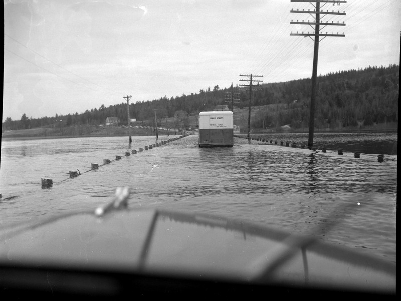
There were many times over the years when canoeing at Maguerrowoc was a necessity rather than a pleasant outing. Until recent improvements the bridge over Maguerrowoc was infamous for washing out as shown in the 1950’s photos above. The bridge was first built in 1827 as reported in the Eastport Sentinel of that year: ” The long anticipated road from Calais west through Baring has been opened and made possible for horses and the great Magurrewalk bridge measuring one hundred and twenty five feet has been completed” The Sentinel’s spelling of Maguerrowoc is another of the many attempts to spell a name with more twists and turns than the Maguerrowoc monster.