Ladies walking in MillCove Robbinston about 1900
One of the most striking and beautiful places on the St. Croix River is Mill Cove in Robbinston where the Ridge Road, formerly the old County Road, and the old Eastport Road, now Route 1, meet. Going south as one crosses the cove provides a view of the bay as it opens in all its splendor. St Andrews and Joe’s Point, which marks the mouth of the St Croix River and the beginning of the Passamaquoddy Bay, are in the distance and in the foreground are the remarkable sandstone cliffs which begin near Route 1 and continue around the point.
Calais Academy Class 1898 at MillCove
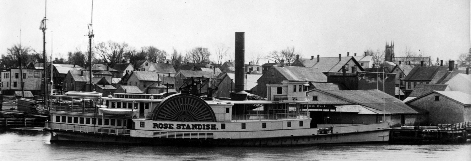
In the past Mill Cove has attracted legions of hikers, campers and groups on outings. The Calais Academy Class of 1898 is shown above on a class picnic. Campers would often take the steamboat from Calais, pitch a tent in the surrounding woods and spend days digging clams and fishing in the bay.
Two Ladies have their photo taken at Pulpit Rock, probably about 1900
Around the point to the south is Pulpit Rock and countless hundreds, possibly thousands, have a photo of their family sitting on the base of the rock.
Pulpit Rock has special significance to the Passamaquoddies. An article published in 1892 in the St Croix Courier authored by Mrs. Wallace Brown, an acknowledged expert on the tribal language and culture in the 1800’s, describes its importance:
“The echoes that are often heard along the eastern shore of the Saint Croix are said to be the cries of an invisible ’Chee-M’taoulin, (Giant Witch); and at Lewy’s Cove, a place nearly opposite St. Andrews, there is a perpendicular ledge called Pulpit Rock, but known to the Indians as M’taoulin-Penobsqu’, on the top of which m’taoulin from different tribes met and held high carnival, although it is quite inaccessible to common humanity. The Bay of Fundy and its environs seem to have been peculiarly adapted to m’taoulin; and we hear of battles, short and decisive, being fought by Keewaqu’ and M’taoulin along its shores. “
Donald Soctomah, Passamaquoddy historian and today’s resident expert on the culture and language of the Passamaquoddies wrote us as follows:
“Pulpit Rock is also known as M’taoulin Rock, which means Medicine Man. The one image faces the rising sun and the other ledge image looks like a fire with four faces on each side (now there is a fish hawk nest on top of it). I go there several times a year and take school kids there to tell them stories of the MTaoulin Rock.”

MillCove, the tide is out. Ridge Road to the right, county road to Eastport to the left
However, for all its splendor, cultural significance and history, Mill Cove has its dark side. Mill Stream parallels the Ridge Road emptying into Mill Cove. Early in the 19th century a bridge carried county road traffic across Mill Stream. The bridge is out of view, behind the building to the bottom right The approach to the bridge from the South, from either the Ridge Road or Route 1 was very dangerous. The road dipped and curved suddenly approaching the bridge which was very narrow and often in need of repair.

Approaching the MillCove bridge from the South, the Ridge Road is at about 2 O’Clock
This very poor photo shows the bridge across Mill Cove in 1932. To the upper left is Route 1 to Eastport, to the right the Ridge Road. Unlike today’s road which sits high above the cove, gently curving toward Woodbine Hill on which the Robbinston School now sits, the bottom of the old bridge was barely above high tide and poorly maintained. The curve approaching from Perry was sharp and the grade downhill. Serious accidents were common on the bridge, complaints to the State Highway Commission were persistent and local residents demanded to no avail that the road be re-routed for years.
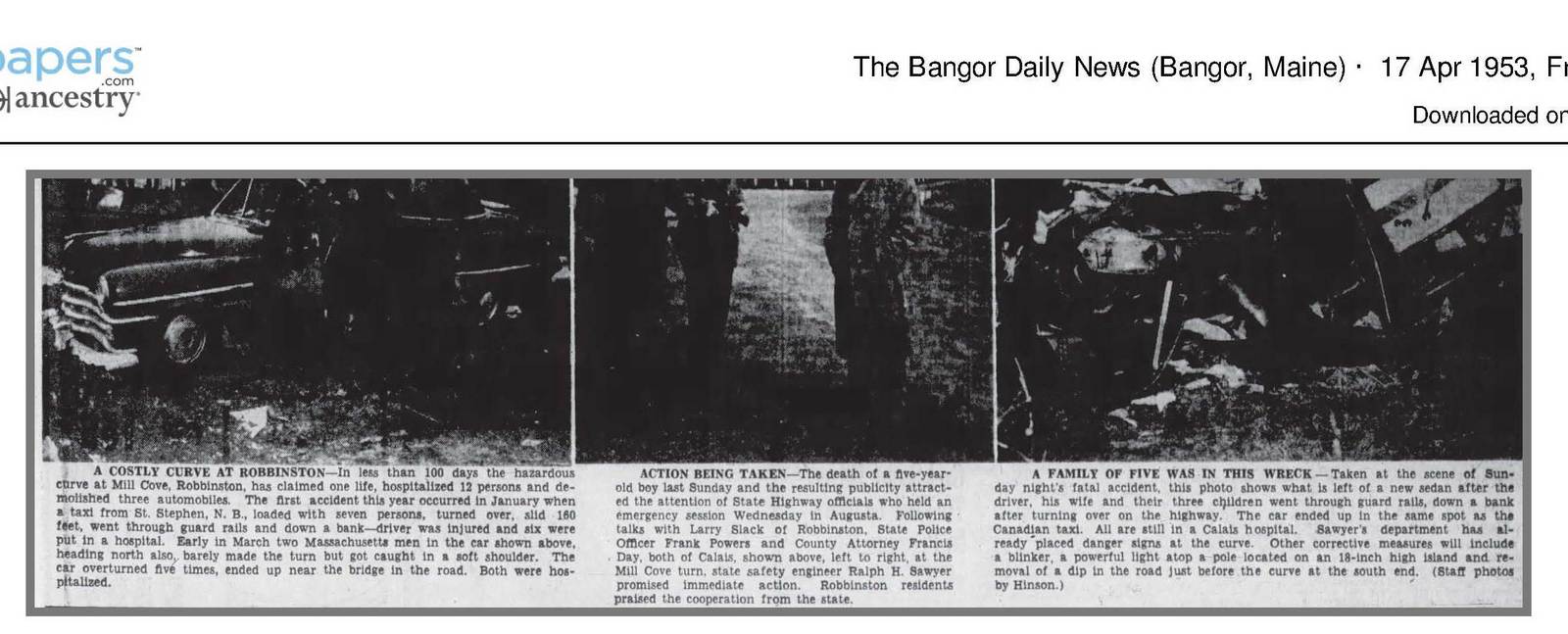
From the Bangor Daily April 17, 1953
One would have thought the Highway Commission would have finally been compelled to act in 1953.
Text from the graphic above which is, unfortunately, a very poor image:
Bangor Daily News April 17th, 1953
A costly curve at Robbinston
In less than 100 days the hazardous curve at Mill Cove, Robbinston has claimed one life, hospitalized 12 persons and demolished 3 automobiles. The first accident this year occurred in January where a taxi from St. Stephen NB loaded with seven persons, turned over, slid 160 feet, went through guardrails and down a bank. The driver was injured and six were put in hospital. Early in March two Massachusetts men in a car shown above, heading north also, barely made the turn but got caught in the soft shoulder. The car overturned five times ending up near the bridge in the road. Both were hospitalized.
Action being taken.
The death of a 5-year-old boy last Sunday and the resulting publicity attracted the attention of the state highway officials who held an emergency session Wednesday in Augusta. Following talks with Larry Slack of Robbinston, state police officer Frank Powers and County Attorney Francis Day, both of Calais, shown above, left to right, at the Mill Cove turn, state safety expert Ralph Sawyer promised immediate action. Robinson residents praised the cooperation from the state.
A family of five was in this wreck.
Taken at the scene of Sunday night’s fatal accident, this photo shows what is left of a new sedan after the driver, his wife and three children went through guardrails down the bank after turning over on the highway. The car ended up in the same spot as the Canadian taxi. All are at the Calais hospital. Sawyers’ department has already placed danger signs at the curve. Other corrective measures will include a blinker, a powerful light atop a pole located on an 18 inch high island and removal of a dip in the row just before the curve at the South end.
The Bangor Daily had reported the January accident as follows:
Bangor Daily News. January 8, 1953:
ROBBINSTON Jan 8, 1953
Three persons were hospitalized as the result of an automobile accident Wednesday night at 11:30 o’clock at Mill Cove Robbinston when the taxi in which they were riding with four others left the road and rolled down an embankment according to State Police… The automobile was demolished. Two of the three injured passengers whose conditions were listed as “satisfactory” by Dr H C Mitchell of Calais are Lyle Pysher 30 of Vineland Ont. suffering from a fractured foot and Loraine Thibeau 16 of St Stephen N B who sustained a lacerated scalp and suffered from exposure. Both Pysher and Mis Thibeau are in the Calais Regional hospital. The third injured passenger was Terry McAllister 24 of St Stephen who sustained a dislocated left hip. Her condition is also reported as satisfactory. Police said the taxi was owned by Earl Hayman of St Stephen and was operated by Neil McLaughlin 27 also of St Stephen.
Other passengers who were uninjured according to police were John Thompson 31 of St Catherine N B: Irene Thibodeau 16 and Doris White 17 both of St Stephen.
Complainant was a State Police officer who said the accident occurred on the south side of the Mill Cove turn on Route 1. The car turned over on its left side and skidded 160 feet on the pavement, broke through a guard rail knocking over several posts and rolled over three times down a steep bank, he said. All of the passengers stayed in the vehicle until it stopped and then managed to crawl out. It was the better part of an hour before the car was noticed and assistance arrived. Miss Thibeau who is suffering from exposure, had walked about 60 feet away from the wreck and had fallen unconscious in heavy undergrowth, the officer said.
This spate of serious accidents and another in which a local electric company truck overturned sending the company employees to the hospital finally got the attention of the State Highway Commission.
April 14, 1953, BDN:
Down East Groups Aroused By Fatal Auto Accident
Seek Elimination Of Curve
CALAIS April 13— The third serious accident this year at Mill Cove in Robbinston— it claimed the life of a five-year-old boy— has prompted citizens of that community to appeal to state highway officials for action on the curve that has been the cause of the accidents.
CANADIAN BOY DIES
A Moncton NB boy John A MacDonald died Monday afternoon of injuries sustained Sunday night when the family car overturned. His parents Mr. and Mrs. Alton MacDonald are in “serious condition” in Calais Regional Hospital authorities said Monday night a brother and sister were also injured.
At a meeting of-the executive committee of the Washington County Chamber of Commerce in Dennysville Monday evening members voted to pass a resolution when the chamber meets Friday to be presented to some state official calling for direct and immediate action to remedy the dangerous road situation at Mill Cove according to committee member Francis E Day of Calais “It’s a shame that a child has to die before authorities will consider action on the Mill Cove turn”
Day said “The chamber feels that it is about time something is done and if highway officials don’t act then we’ll find someone who will” he asserted.
Getting the attention of the Highway Commission didn’t result in the action demanded by locals. An engineer from the State investigated and agreed to place warning lights and signs at the south end of the bridge but did not agree to re-routing the road as proposed by residents. It took a tragic accident in 1964 to finally get action.
4 MAINE WOMEN KILLED, FIFTH MISSING AS CAR GOES INTO QUODDY BAY ROBBINSTON
(AP)- Lewiston Sun 17 February 1964
Four members of a women’s bowling team drowned Sunday when their car slid off US Route One during a northeast gale and landed upside down in a Passamaquoddy Bay Cove. Authorities were searching for a possible fifth victim.
The bowling team from Machias was traveling to Calais for a match, authorities said.
Searchers traced over a half a mile of mudflats in a severe snowstorm Sunday night for Mrs. Thelma Norton of Machias or her body. The search is scheduled to resume Monday with assistance from the Coast Guard and a State Fish and Game Department plane.
The car was totally submerged at high tide. County Attorney Francis Brown said the windshield was broken and someone may have gotten out of the vehicle.
A screen was stretched across the mouth of the cove to prevent the tide from carrying a body out to sea.
The bodies found in the car were identified as those of Mrs. Lucie P. Dunn 53 of Machiasport, Mrs. Glenice M. Hill 33 and Mrs. Bertha W. Anthony 44 both of Machias and Miss Hannah McMullen about 43 of Whitneyville just outside Machias.
Dr James Bates, a medical examiner said all four drowned.
Brown said wrist watches found on some of the bodies had stopped at about 1 pm.
But it was an hour later that the accident was reported by a state plow operator who noticed that seven sections of guard rails had been broken.
The spot is just south of a small bridge over Mill Cove Stream which lies in a slight dip in the road at the end of a sharp curve. Brown said the driver — he presumed it was the Dunn woman because the car was registered in her name — apparently lost control just before she reached the bridge. The car toppled about 15 feet into the stream landing on its roof at high tide. The Dunn woman’s body was found in the front seat, those of the other victims were in back.
Brown said the Norton woman presumably was in the front seat with the driver. The scene is at the head of Passamaquoddy Bay just beyond the mouth of the Saint Croix River, the international boundary between Maine and New Brunswick. Robbinston is about 15 miles South of Calais and opposite St. Andrews NB.
Nine days later the body Thelma Norton of Machias was discovered on Clam Cove Beach on Deer Island, six miles from Mill Cove. Newspapers throughout the United States and Canada carried the story.

After decades of pressure and many deaths the road was re-routed and raised high above the cove
Finally the relocation of the road began in 1966. The old road and bridge can be seen at about 10 O’clock. The new road can be seen in the center of the photo.
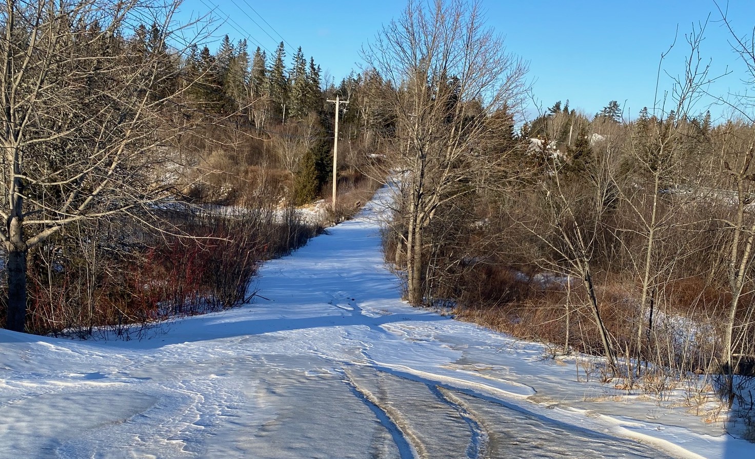
The old road today
The old road where the driver of the vehicle lost control is now somewhat overgrown but still clearly visible just to the right after turning onto the Ridge Road. Guardrails and the new road can be seen on the far right at about 2 o’clock.