The walking path on the old railroad bed along the river is a wonderful asset to the
community. It goes from the bottom of Barker Street to Todd Street, about a mile and a
half. However for the adventurous it really makes no sense to stop at Todd Street, the
path continues for about a quarter of a mile beyond Todd Street and then the railroad
tracks begin but it is really quite easy to continue by walking along or on the railroad ties
If you do you will first comes to Salmon Falls at Knight’s Corner, next is the Milltown
Customs Station and then on to the bridges built over the tracks to accommodate the new
bridge until you arrive at Maguerrewock. At this point the river is on the right and the
marsh, always teeming with ducks, geese and small critters, is on the left. Across the
marsh to the left is Route 1. Continuing on the tracks from there takes you along the river
and finally to the Baring railroad bridge.
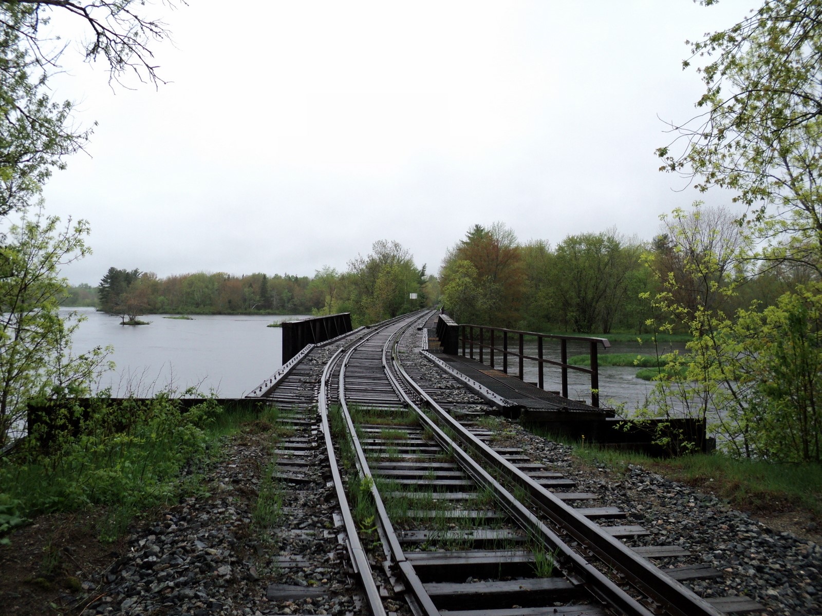
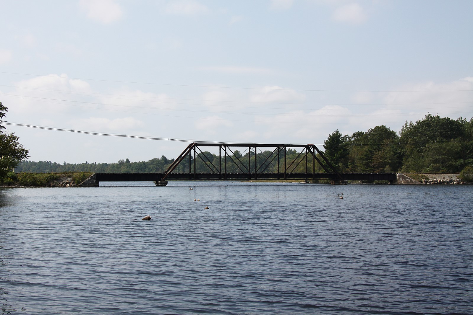
Baring Bridge May 2013
This bridge is interesting for a couple of reasons, first it is still used to transport supplies
to the Woodland Mill and second because the far side of the bridge is in Canada. Other
than sensors and cameras this border is unguarded although crossing into Canada might
result in some rather quick reaction from the authorities.
The original Baring railroad bridge was built in the 1850s to connect the Calais and
Baring Railroad with the Lewey’s Island (Princeton) line. From the Sunrise Route, a
local railroad history:
“The Lewy’s Island Railroad connected with the Calais & Baring RR on the Canadian
side of the river, opposite the town of Baring. Then, it ran four and a half miles to
Sprague’s Falls, where it crossed the St. Croix River back into the United States. The
surveys had found the Canadian side to be more level as well as shorter than the
American side. Veering northerly from Sprague’s Falls, the line coursed through seven
miles of wet and boggy land, eventually reaching the small depot at Squirrel Point in
Baileyville Township. Here, the line turned northwestward for a mile and a half before
closing in on the river to the north and the Tomah Road on the south. Upon reaching
Princeton, two sidings branched off to serve Putnam Rolfe’s saw, stay and planing mill.”
This is how Baring looked from the Canadian side in the old days:

Baring Bridge looking from Canadian side toward Baring
The track then proceeded about four miles on the Canadian side until it crossed back into
the United States at a place then called Sprague’s Falls. The original bridge, built in the
1850’s, was a covered bridge. This came back into Sprague Falls a mile or two above the
mill. Of course, the town was later incorporated and finally named Baileyville but this
was over half a century after the bridge pictured below was built.
From the Sunrise Route:
“The little four-and-a-half-mile section of track in Canada was useful to the railroad.
Halfway along this section, a vein of water intersected a ledge high above the tracks. It made a convenient water stop for the locomotives. This section had also saved the Lewy’s
Island RR from traveling extra miles by following the river on the Canadian side.”
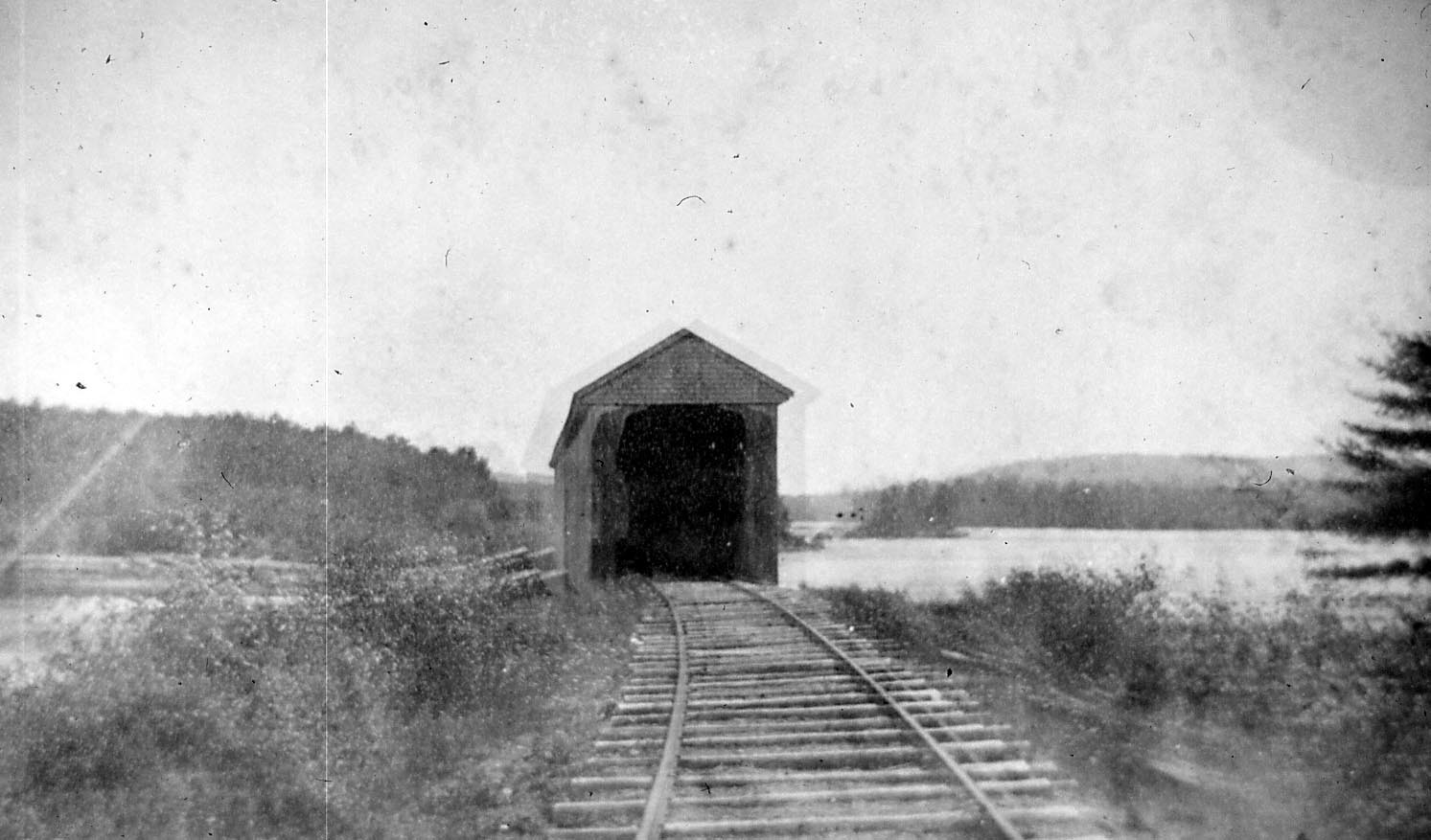
The 1850s covered bridge at Woodland looking into Canada
The Canadian route was shorter and flatter and, in those days, no one bothered with the
technicalities associated with international borders, customs or immigration law. Several
trains crossed and recrossed the border daily without inspection and largely without
incident. There were occasionally problems with legal jurisdiction when the train was on
the Canadian side. According to our treasured historian Ned Lamb:
“There had been an excursion to Princeton and one man celebrated entirely too much,
and they had to arrest him and put the cuffs on to handle him. He was put into the
smoking car to go to Calais. When the train got over the bridge and into Canada, some of
his friends pulled the car coupling and stopped the train, and then demanded that the
officer take the cuffs off and let him go as he was then on Canadian soil. That had to be
done, and the man walked the rest of the way, probably with some of his friends to steer
him straight. Life can be complicated along the St. Croix.”
Today the bridge which comes back across into Woodland is called Black’s Bridge. It is
pictured below. Perhaps this steel bridge replaced the old, covered bridge after the
incident, again reported by Ned Lamb occurred.
“Just why he did it we do not know. He may have thought he was smart, he may have had
some spite against the railroad, he may have been just “cussed”, but a certain man set
fire, and burned the bridge at Spragues’ Falls. He must have done it at night because the
smoke was not noticed in the morning. The next morning the train left Calais about 7:30
behind the Princeton engine. The set was as follows: Conductor, Charles MacDonald;
Engineer, Wallace Haycock; Fireman, John McCurdy; Brakeman, Billie Burton. The
place where the bridge wasn’t was noticed in time for the engineer and fireman to jump,
but not in time to keep engine from going into the hole and dragging the tender after her.
The old engine carried a big dent in her boiler all the rest of her days.”
Black’s Bridge today from the water
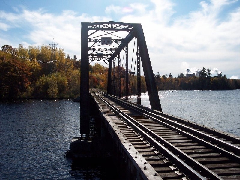
Black’s Bridge today just above the mill looking into Canada
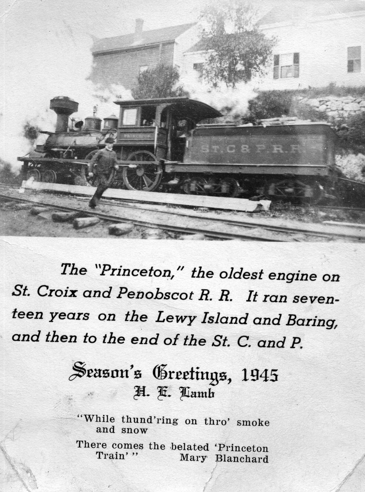
Below is a photo of the locomotive Princeton which was mentioned above from a Christmas card sent many, many years ago by Ned Lamb.